Last Updated on Wednesday, 12 October 2022, 9:18 by Denis Chabrol
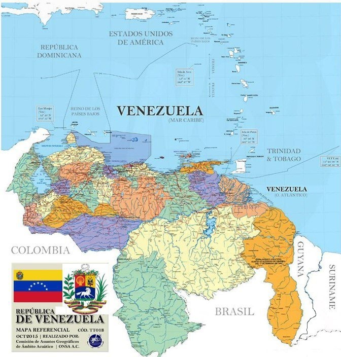
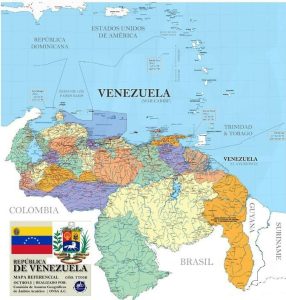
One of the maps on Facebook that depict the Essequibo Region as part of Venezuela
Guyana has requested Facebook and Twitter to remove maps that depict the mineral and forest-rich Essequibo Region as part of Venezuela, and already one of the Social Media companies has asked for a meeting with Foreign Secretary Robert Persaud to discuss the concerns.
Mr Persaud, in his letters of protest to Facebook and Twitter last week, cautioned that the propagation of such images breaches the United Nations Charter and the policies of those two Social Media companies. He also warned that if nothing is done to remove those images, Guyana’s interests at the World Court could be harmed. “I wish to point out that Facebook (and Twitter) posts and the subsequent comments surrounding the particular posts, have the potential to permanently damage relations between States, incite violence against the territory and people of Guyana, and derail the current adjudication of the matter before the International Court of Justice (ICJ),” Foreign Secretary Robert Persaud said.
The Essequibo Region, which is part of Guyana’s territory, has been settled as part of this country’s territory since the 1899 Arbitral Tribunal Award that settled the land boundary between Venezuela and then British Guiana, now Guyana.
He is due to meet with representatives of Facebook in the coming days, in response to Guyana’s concerns.
The Foreign Ministry said it was prompted to write Facebook and Twitter after a fresh, orchestrated campaign of disinformation being waged against Guyana by a number of Spanish language Social Media accounts that claim Guyana’s territory.
Persaud asked Facebook and Twitter to remove those posts as they violate the United Nations Charter and their own social media rules. “In this regard, I am requesting that these types of Facebook posts (and Twitter) which violate the basic tenet of international relations between States, the sovereignty and territorial integrity of the Cooperative Republic of Guyana and incite a threat of use of force against Guyana, be removed forthwith and more stringent measure be taken against their publications,’’ the Foreign Secretary’s letter stated.
After the 1899 Arbitral Award, the boundary was demarcated on the ground between 1900 and 1904 by Commissioners appointed by Britain and Venezuela. On January 7, 1905, the official boundary map delineating the boundary as awarded and demarcated, was drawn up and signed by the Commissioners of both Britain and Venezuela and promulgated in Georgetown, at the Combined Court, the Foreign Ministry said.
For decades now, Venezuela’s official maps have been showing that the Essequibo Region is part of the Zone of Reclamation.